Geolocate

Banham topographic map

Click on the map to display elevation.

About this map

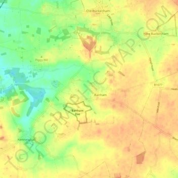
Name: Banham topographic map, elevation, terrain.

Location: Banham, Breckland District, Norfolk, England, United Kingdom (52.43305 0.99072 52.47040 1.09679)

Average elevation: 151 ft

Minimum elevation: 82 ft

Maximum elevation: 194 ft

Gear up for your next adventure:

🔌Solar Panel Charger - Charge gear sustainably outdoors
🎒Day Hiking Backpack - Lightweight backpack perfect for day trips and outdoor adventures
🧯Portable Fire Pit - Compact fire pit for camping spots
🦶Carbon Trekking Poles - Reduce knee impact on steep descents with ultra-light poles
🎒Gear Packing Cubes - Organize your backpack efficiently

As an Amazon Associate, this site earns from qualifying purchases at no extra cost to you.