Geolocate

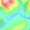
Ballyknockan topographic map

Click on the map to display elevation.

About this map

Name: Ballyknockan topographic map, elevation, terrain.

Location: Ballyknockan, The Municipal District of Baltinglass, County Wicklow, Leinster, Ireland (53.08689 -6.51312 53.12689 -6.47312)

Average elevation: 1,014 ft

Minimum elevation: 591 ft

Maximum elevation: 2,297 ft

Other topographic maps

Click on a map to view its topography, its elevation and its terrain.

Baltinglass

Ireland > County Wicklow

A nineteenth-century explanation is found in Samuel Lewis' A Topographical Dictionary of Ireland, where he says that the name, "according to most antiquaries," comes from Baal-Tin-Glas, meaning the "pure fire of Baal," and that this suggests that the area was a centre for "druidical worship".

Average elevation: 535 ft
Blessington

Ireland > County Wicklow

Average elevation: 669 ft

Dunlavin

Ireland > County Wicklow

Average elevation: 568 ft

Rathnew

Ireland > County Wicklow

Average elevation: 118 ft

Clone

Ireland > County Wicklow

Average elevation: 564 ft

Aughrim

Ireland > County Wicklow

Average elevation: 404 ft

Randalstown

Ireland > County Wicklow

Average elevation: 535 ft

Tornant Upper

Ireland > County Wicklow

Average elevation: 699 ft

Avoca

Ireland > County Wicklow

Average elevation: 308 ft

Dunlavin Lower

Ireland > County Wicklow

Average elevation: 502 ft

Lough Tay

Ireland > County Wicklow

Average elevation: 1,296 ft

Ballintemple

Ireland > County Wicklow

Average elevation: 377 ft

Vartry

Ireland > County Wicklow

Average elevation: 758 ft

Vartry Reservoir Lower

Ireland > County Wicklow

Average elevation: 751 ft

Enniskerry

Ireland > County Wicklow

Average elevation: 364 ft

Killiniskyduff

Ireland > County Wicklow

Average elevation: 79 ft

Avoca

Ireland > County Wicklow

Average elevation: 384 ft

Yardland

Ireland > County Wicklow

Average elevation: 75 ft

Kilquade

Ireland > County Wicklow

Average elevation: 200 ft

Carnew

Ireland > County Wicklow

Average elevation: 308 ft

Arklow

Ireland > County Wicklow

Average elevation: 46 ft

Gear up for your next adventure:

🛠️Outdoor Gear Repair Kit - Essential tools to fix gear on the trail
🛰️Handheld GPS Units - Professional satellite navigators for precise backcountry mapping
🥤Water Filter Bottle - All‑in‑one filter bottle for safe hydration
👟Trail Running Shoes - Lightweight shoes for trail runners
❄️Traction Cleats - Prevent slips on icy trails during winter hikes

As an Amazon Associate, this site earns from qualifying purchases at no extra cost to you.