Geolocate

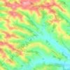
Courrensan topographic map

Click on the map to display elevation.

About this map

Name: Courrensan topographic map, elevation, terrain.

Location: Courrensan, Condom, Gers, Occitania, Metropolitan France, 32330, France (43.81338 0.17430 43.87042 0.29341)

Average elevation: 456 ft

Minimum elevation: 285 ft

Maximum elevation: 682 ft

Other topographic maps

Click on a map to view its topography, its elevation and its terrain.

Le Tourmalet

France > Occitania > Gers > Saint-Pierre-d'Aubézies

Average elevation: 568 ft

Tucon

France > Occitania > Gers > Gazax-et-Baccarisse > Gazax

Average elevation: 643 ft

Gaugens

France > Occitania > Gers > Ordan-Larroque

Average elevation: 643 ft

Lamaison

France > Occitania > Gers > Tournan

Average elevation: 820 ft

Tucon

France > Occitania > Gers > Gazax-et-Baccarisse

Average elevation: 643 ft

Loc

France > Occitania > Gers > Caupenne-d'Armagnac

Average elevation: 354 ft

Balarin

France > Occitania > Gers > Montréal

Average elevation: 420 ft

Gear up for your next adventure:

🛶Inflatable Kayak - Portable kayak for rivers, lakes, and expeditions
🏕️Family Camping Gear - Essentials for group camping trips
🪶Wildlife Field Guides - Learn animal tracking and species ID
🎒Trekking Poles - Sturdy poles for balance and stability on rough terrain
🪶Survival Guide Book - Expert advice for emergency preparedness

As an Amazon Associate, this site earns from qualifying purchases at no extra cost to you.