Geolocate

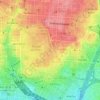
Moncloa-Aravaca topographic map

Click on the map to display elevation.

About this map

Name: Moncloa-Aravaca topographic map, elevation, terrain.

Location: Moncloa-Aravaca, Madrid, Community of Madrid, Spain (40.39910 -3.83835 40.48029 -3.70827)

Average elevation: 2,169 ft

Minimum elevation: 1,893 ft

Maximum elevation: 2,434 ft

Other topographic maps

Click on a map to view its topography, its elevation and its terrain.
Madrid

Spain > Community of Madrid > Madrid

Average elevation: 2,133 ft

Fuente de las Gaviotas

Spain > Community of Madrid > Madrid

Average elevation: 2,149 ft

Gear up for your next adventure:

🪶Multi‑Purpose Knife - Useful blade for camp and trail
🗺️Topographic Maps - Detailed topo maps for hiking, exploring and outdoor navigation
🔦Compact Flashlight - Reliable flashlight for emergencies
🔊Portable Camp Speaker - Music and alerts at camp
🛌Ultralight Sleeping Bags - Compact down bags for cold nights in the wilderness

As an Amazon Associate, this site earns from qualifying purchases at no extra cost to you.