
Thank you for supporting this site ❤️
Make a donation
Make a donation
Gear up for your next adventure:
As an Amazon Associate, this site earns from qualifying purchases at no extra cost to you.
Werdau topographic map
Click on the map to display elevation.
Thank you for supporting this site ❤️
Make a donation
Make a donation
Gear up for your next adventure:
As an Amazon Associate, this site earns from qualifying purchases at no extra cost to you.
About this map
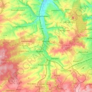
Name: Werdau topographic map, elevation, terrain.
Location: Werdau, Zwickau, Saxony, 08412, Germany (50.68245 12.25261 50.77686 12.44237)
Average elevation: 1,076 ft
Minimum elevation: 814 ft
Maximum elevation: 1,332 ft
Thank you for supporting this site ❤️
Make a donation
Make a donation
Gear up for your next adventure:
As an Amazon Associate, this site earns from qualifying purchases at no extra cost to you.