Geolocate

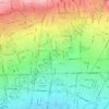
Hesarak topographic map

Click on the map to display elevation.

About this map

Name: Hesarak topographic map, elevation, terrain.

Location: Hesarak, ناحیه ۳, District 5, Tehran, Central Tehran section, Tehran County, Tehran Province, Iran (35.77474 51.29892 35.79034 51.32535)

Average elevation: 5,492 ft

Minimum elevation: 4,908 ft

Maximum elevation: 6,834 ft

Other topographic maps

Click on a map to view its topography, its elevation and its terrain.

traffic

Iran > Tehran Province > Tehran County > Tehran

Average elevation: 4,360 ft

Laleh Park

Iran > Tehran Province > Tehran County > Tehran

Average elevation: 4,085 ft

میدان صنعت

Iran > Tehran Province > Tehran County > Tehran

Average elevation: 4,731 ft

Arghavan

Iran > Tehran Province > Tehran County > Tehran

Average elevation: 4,587 ft

Laleh Park

Iran > Tehran Province > Tehran County > Tehran

Average elevation: 4,085 ft

Laleh Park

Iran > Tehran Province > Tehran County > Tehran

Average elevation: 4,085 ft

Laleh Park

Iran > Tehran Province > Tehran County > Tehran

Average elevation: 4,085 ft

Talash 2 Park

Iran > Tehran Province > Tehran County > Tehran

Average elevation: 3,717 ft

Gear up for your next adventure:

🧦Merino Wool Socks - Moisture-wicking, blister-preventing socks for long treks
🍳Camping Cook Set - Complete cookware for outdoor meals
🔪Outdoor Multitools - Essential survival tools for gear repair and field use
📌Outdoor GPS Map App - Apps and devices for digital topographic navigation
📶Satellite Messenger - Communication device off‑grid

As an Amazon Associate, this site earns from qualifying purchases at no extra cost to you.