
Thank you for supporting this site ❤️
Make a donation
Make a donation
Gear up for your next adventure:
As an Amazon Associate, this site earns from qualifying purchases at no extra cost to you.
Mabonde topographic map
Click on the map to display elevation.
Thank you for supporting this site ❤️
Make a donation
Make a donation
Gear up for your next adventure:
As an Amazon Associate, this site earns from qualifying purchases at no extra cost to you.
About this map
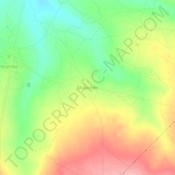
Name: Mabonde topographic map, elevation, terrain.
Location: Mabonde, Chitambo District, Central Province, Zambia (-12.94020 30.63516 -12.90020 30.67516)
Average elevation: 4,957 ft
Minimum elevation: 4,764 ft
Maximum elevation: 5,167 ft
Thank you for supporting this site ❤️
Make a donation
Make a donation
Gear up for your next adventure:
As an Amazon Associate, this site earns from qualifying purchases at no extra cost to you.