Geolocate

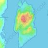
Luing topographic map

Click on the map to display elevation.

About this map

Name: Luing topographic map, elevation, terrain.

Location: Luing, Toberonochy, Argyll and Bute, Scotland, United Kingdom (56.18816 -5.66578 56.27083 -5.61762)

Average elevation: 43 ft

Minimum elevation: -7 ft

Maximum elevation: 853 ft

Other topographic maps

Click on a map to view its topography, its elevation and its terrain.
Shuna

United Kingdom > Scotland > Argyll and Bute > Toberonochy

Average elevation: 30 ft

Gear up for your next adventure:

🦶Carbon Trekking Poles - Reduce knee impact on steep descents with ultra-light poles
🌲Outdoor Survival Books - Best books on survival skills
🩳Quick‑Dry Hiking Shorts - Comfortable and quick‑dry shorts for summer hiking
🧤Hiking Gloves - Protective gloves for rugged trails
🪶Compact Camp Shovel - Folding shovel for campsite tasks

As an Amazon Associate, this site earns from qualifying purchases at no extra cost to you.