Geolocate

Chiquintad topographic map

Click on the map to display elevation.

About this map

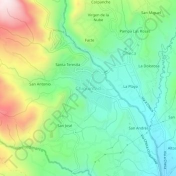
Name: Chiquintad topographic map, elevation, terrain.

Location: Chiquintad, Cuenca, Azuay, 010115, Ecuador (-2.83302 -79.02220 -2.79302 -78.98220)

Average elevation: 9,219 ft

Minimum elevation: 8,468 ft

Maximum elevation: 10,732 ft

Other topographic maps

Click on a map to view its topography, its elevation and its terrain.

Río Tomebamba

Ecuador > Azuay > Cuenca

Average elevation: 8,212 ft

San Sebastián

Ecuador > Azuay > Cuenca

Average elevation: 9,026 ft

Gear up for your next adventure:

🔦LED Headlamp - Bright and durable LED headlamp for night navigation
🔋Rechargeable Batteries - Power up your outdoor devices
🌡️Portable Weather Meter - Track weather conditions on the trail
🧥Men's Rain Shells - Premium waterproof and breathable jackets for mountain weather
🎒Day Hiking Backpack - Lightweight backpack perfect for day trips and outdoor adventures

As an Amazon Associate, this site earns from qualifying purchases at no extra cost to you.