Geolocate

Don Bosco topographic map

Click on the map to display elevation.

About this map
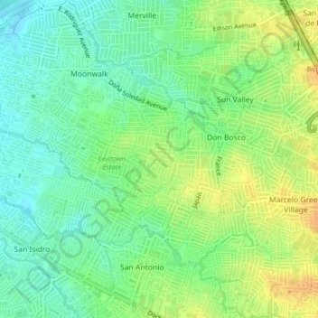
Name: Don Bosco topographic map, elevation, terrain.

Location: Don Bosco, Parañaque District 2, Parañaque, Southern Manila District, Metro Manila, 1711, Philippines (14.47255 121.00697 14.49103 121.04578)

Average elevation: 75 ft

Minimum elevation: 26 ft

Maximum elevation: 135 ft

Other topographic maps

Click on a map to view its topography, its elevation and its terrain.

Baltao Subdivision

Philippines > Parañaque

Average elevation: 30 ft

Gear up for your next adventure:

🥇GPS Hiking Watch - Multi‑sport GPS watch with navigation and trail tracking
🧣Merino Neck Gaiters - Multi-functional headwear for wind and sun protection
🎒Gear Packing Cubes - Organize your backpack efficiently
❄️Traction Cleats - Prevent slips on icy trails during winter hikes
🥩Freeze-Dried Meals - Nutritious and lightweight food for remote expeditions

As an Amazon Associate, this site earns from qualifying purchases at no extra cost to you.