Geolocate

Flensburg topographic map

Click on the map to display elevation.

About this map

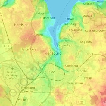
Name: Flensburg topographic map, elevation, terrain.

Location: Flensburg, Schleswig-Holstein, 24937, Germany (54.74330 9.39333 54.82330 9.47333)

Average elevation: 128 ft

Minimum elevation: -7 ft

Maximum elevation: 266 ft

Other topographic maps

Click on a map to view its topography, its elevation and its terrain.

Friedhof

Germany > Schleswig-Holstein > Flensburg

Average elevation: 138 ft

Exe

Germany > Schleswig-Holstein > Flensburg

Average elevation: 118 ft

Gear up for your next adventure:

🚗GPS Dash Cams - Record your scenic drives through mountain passes and canyons
🎁Geography Themed Gifts - Unique gift ideas for map lovers and geography enthusiasts
💧Water Filtration Bottles - Safely drink from streams and lakes while exploring
🦶Hiking Gaiters - Keep debris and water out of your boots
🔦Compact Flashlight - Reliable flashlight for emergencies

As an Amazon Associate, this site earns from qualifying purchases at no extra cost to you.