Geolocate

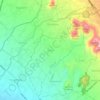
Donomulyo topographic map

Click on the map to display elevation.

About this map

Name: Donomulyo topographic map, elevation, terrain.

Location: Donomulyo, Magelang, Central Java, 56193, Indonesia (-7.43122 110.25817 -7.39122 110.29817)

Average elevation: 1,608 ft

Minimum elevation: 1,371 ft

Maximum elevation: 1,975 ft

Other topographic maps

Click on a map to view its topography, its elevation and its terrain.
Kaliurang

Indonesia > Central Java > Magelang

Average elevation: 2,520 ft

Salam

Indonesia > Central Java > Magelang

Average elevation: 932 ft

Muntilan

Indonesia > Central Java > Magelang

Average elevation: 971 ft

Kaliurang

Indonesia > Central Java > Magelang

Average elevation: 2,520 ft

Ngablak

Indonesia > Central Java > Magelang

Average elevation: 2,064 ft

Gear up for your next adventure:

🌄Hiking Binoculars - Compact binoculars for scenic views and trail spotting
🧭Compass with Lanyard - Easy‑carry compass for navigation
🌧️Backpack Rain Cover - Keep gear dry in wet weather
🌐World Map Poster - Decorative world maps with topographic info
⛺Backpacking Tents - Weight-optimized shelters for multi-day topographic surveys

As an Amazon Associate, this site earns from qualifying purchases at no extra cost to you.