Geolocate

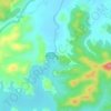
Haobi topographic map

Click on the map to display elevation.

About this map

Name: Haobi topographic map, elevation, terrain.

Location: Haobi, Churachandpur Subdivision, Churachandpur district, Manipur, India (24.18440 93.78216 24.18450 93.78226)

Average elevation: 4,088 ft

Minimum elevation: 2,831 ft

Maximum elevation: 5,092 ft

Other topographic maps

Click on a map to view its topography, its elevation and its terrain.
Khuga Dam

India > Manipur > Churachandpur subdivision > Saipum

Average elevation: 2,785 ft

Gear up for your next adventure:

🛡️Bear Spray Outdoor - Protection in bear country hikes
🪄Magnetic Compass - Accurate compass for navigation
🧴Hand Sanitizer - Keep hands clean while hiking
📱Solar Portable Charger - Solar power bank for charging devices off‑grid
💧Water Purification System - Clean water on the trail with reliable purifiers

As an Amazon Associate, this site earns from qualifying purchases at no extra cost to you.