Geolocate

Rincon topographic map

Click on the map to display elevation.

About this map

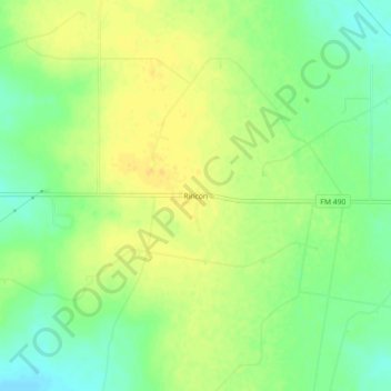
Name: Rincon topographic map, elevation, terrain.

Location: Rincon, Starr County, Texas, United States (26.49451 -98.61280 26.53451 -98.57280)

Average elevation: 446 ft

Minimum elevation: 397 ft

Maximum elevation: 479 ft

Starr County trails, hiking, mountain biking, running and outdoor activities

Other topographic maps

Click on a map to view its topography, its elevation and its terrain.

Rio Grande

United States > Texas > Starr County

Average elevation: 256 ft

Escobares

United States > Texas > Starr County > Escobares

Average elevation: 203 ft

Rio Grande

United States > Texas > Starr County > Roma > Campobello Colonia

Average elevation: 207 ft

Gear up for your next adventure:

☀️Outdoor Sunscreen - High protection sunscreen for outdoor activities
🛠️Backpacking Tool Kit - Essential toolkit for outdoor repairs
🔥Plasma Lighters - Windproof lighters that work in any weather condition
🧭Hiking Compass - Precision compass for reliable navigation in the wilderness
🚗GPS Dash Cams - Record your scenic drives through mountain passes and canyons

As an Amazon Associate, this site earns from qualifying purchases at no extra cost to you.