
Frauenwald topographic map
Interactive map
Click on the map to display elevation.
About this map
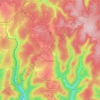
Name: Frauenwald topographic map, elevation, terrain.
Location: Frauenwald, Ilmenau, Ilm-Kreis, Thüringen, Duitsland (50.56143 10.82552 50.62291 10.89665)
Average elevation: 2,349 ft
Minimum elevation: 1,657 ft
Maximum elevation: 2,756 ft
Other topographic maps
Click on a map to view its topography, its elevation and its terrain.