Geolocate

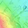
Elahiyeh Community topographic map

Click on the map to display elevation.

About this map

Name: Elahiyeh Community topographic map, elevation, terrain.

Location: Elahiyeh Community, Quarter 2 of District 12, District 12, Mashhad, بخش مرکزی شهرستان مشهد, Mashhad County, Razavi Khorasan, Iran (36.36540 59.44849 36.39379 59.50021)

Average elevation: 3,514 ft

Minimum elevation: 3,353 ft

Maximum elevation: 3,684 ft

Other topographic maps

Click on a map to view its topography, its elevation and its terrain.
Mountain Park

Iran > Razavi Khorasan > Mashhad County > Mashhad

Average elevation: 4,206 ft

Gear up for your next adventure:

🛰️Satellite Messengers - Emergency SOS and two-way messaging for off-grid adventures
🔌Solar Panel Charger - Charge gear sustainably outdoors
🏕️Tent Footprint - Protect your tent base from wear
⛑️Personal Locator Beacon - Safety beacon for emergencies
🔥Fast-Boil Camping Stoves - Efficient cooking systems for quick trail meals

As an Amazon Associate, this site earns from qualifying purchases at no extra cost to you.