Geolocate

Padmanabhapuram topographic map

Click on the map to display elevation.

About this map
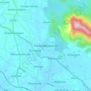
Name: Padmanabhapuram topographic map, elevation, terrain.

Location: Padmanabhapuram, Kalkulam, Kanniyakumari, Tamil Nadu, 629175, India (8.21152 77.28459 8.29152 77.36459)

Average elevation: 344 ft

Minimum elevation: 59 ft

Maximum elevation: 3,002 ft

Other topographic maps

Click on a map to view its topography, its elevation and its terrain.

Thuckalay

India > Tamil Nadu > Kalkulam

Average elevation: 335 ft

Gear up for your next adventure:

🛠️Outdoor Gear Repair Kit - Essential tools to fix gear on the trail
🔥Fast-Boil Camping Stoves - Efficient cooking systems for quick trail meals
🛡️Bear Spray Outdoor - Protection in bear country hikes
🔌Solar Panel Charger - Charge gear sustainably outdoors
📶Satellite Messenger - Communication device off‑grid

As an Amazon Associate, this site earns from qualifying purchases at no extra cost to you.