Geolocate

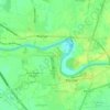
Culianin topographic map

Click on the map to display elevation.

About this map

Name: Culianin topographic map, elevation, terrain.

Location: Culianin, Plaridel, Bulacan, Central Luzon, Philippines (14.90820 120.88974 14.92309 120.91165)

Average elevation: 43 ft

Minimum elevation: 10 ft

Maximum elevation: 62 ft

Other topographic maps

Click on a map to view its topography, its elevation and its terrain.
Sipat

Philippines > Bulacan > Plaridel

Average elevation: 26 ft

Lalangan

Philippines > Bulacan > Plaridel

Average elevation: 30 ft

Isla de Pulilan

Philippines > Bulacan > Plaridel > Banga Ⅱ

Average elevation: 33 ft

Banga Ⅰ

Philippines > Bulacan > Plaridel

Average elevation: 33 ft

Lumang Bayan

Philippines > Bulacan > Plaridel

Average elevation: 33 ft

Banga Ⅰ

Philippines > Bulacan > Plaridel

Average elevation: 33 ft

Lumang Bayan

Philippines > Bulacan > Plaridel

Average elevation: 33 ft

Gear up for your next adventure:

🦶Carbon Trekking Poles - Reduce knee impact on steep descents with ultra-light poles
🔭Telescopic Hiking Pole - Adjustable pole for hiking stability
🔦LED Headlamp - Bright and durable LED headlamp for night navigation
🥄Camping Utensil Set - Lightweight utensils for outdoor meals
🦶Hiking Gaiters - Keep debris and water out of your boots

As an Amazon Associate, this site earns from qualifying purchases at no extra cost to you.