
Thank you for supporting this site ❤️
Make a donation
Make a donation
Gear up for your next adventure:
As an Amazon Associate, this site earns from qualifying purchases at no extra cost to you.
Redín topographic map
Click on the map to display elevation.
Thank you for supporting this site ❤️
Make a donation
Make a donation
Gear up for your next adventure:
As an Amazon Associate, this site earns from qualifying purchases at no extra cost to you.
About this map
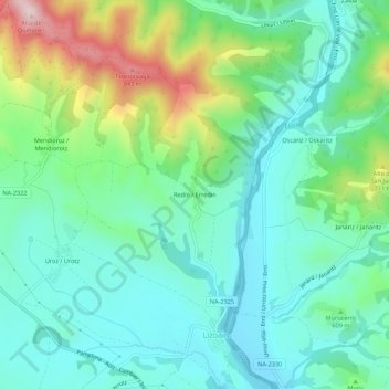
Name: Redín topographic map, elevation, terrain.
Location: Redín, Lizoain-Arriasgoiti, Prepirineo, Navarra, España (42.79373 -1.49077 42.83373 -1.45077)
Average elevation: 1,949 ft
Minimum elevation: 1,617 ft
Maximum elevation: 2,854 ft
Thank you for supporting this site ❤️
Make a donation
Make a donation
Gear up for your next adventure:
As an Amazon Associate, this site earns from qualifying purchases at no extra cost to you.