Geolocate

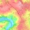
Paderne topographic map

Click on the map to display elevation.

About this map

Name: Paderne topographic map, elevation, terrain.

Location: Paderne, Bazar, Lugo, Galicia, 27210, España (42.92234 -7.62774 42.96234 -7.58774)

Average elevation: 1,906 ft

Minimum elevation: 1,555 ft

Maximum elevation: 2,201 ft

Other topographic maps

Click on a map to view its topography, its elevation and its terrain.
Teixeiro

España > Galicia > Lugo > Lugo

Average elevation: 1,726 ft

Meilán

España > Galicia > Lugo > Lugo

Average elevation: 1,496 ft

Carballido

España > Galicia > Lugo > Lugo

Average elevation: 1,660 ft

Coeses

España > Galicia > Lugo > Lugo

Average elevation: 1,467 ft

Vilachá

España > Galicia > Lugo > Lugo

Average elevation: 1,729 ft

Gear up for your next adventure:

🪵Folding Camp Saw - Compact saw for wood and campsite work
🔪Outdoor Multitools - Essential survival tools for gear repair and field use
🥾Men's Hiking Boots - Durable, waterproof footwear for rugged terrain and steep inclines
🥩Freeze-Dried Meals - Nutritious and lightweight food for remote expeditions
🌡️Portable Weather Meter - Track weather conditions on the trail

As an Amazon Associate, this site earns from qualifying purchases at no extra cost to you.