Geolocate

Chutuque topographic map

Click on the map to display elevation.

About this map

Name: Chutuque topographic map, elevation, terrain.

Location: Chutuque, Cristo nos Valga, Sechura, Piura, Perú (-5.56247 -80.62967 -5.52247 -80.58967)

Average elevation: 49 ft

Minimum elevation: 13 ft

Maximum elevation: 95 ft

Other topographic maps

Click on a map to view its topography, its elevation and its terrain.
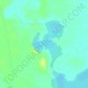
Laguna Ñapique Chico

Perú > Piura > Cristo nos Valga

Average elevation: 39 ft

Gear up for your next adventure:

🗺️NatGeo Topo Maps - High-quality waterproof printed topographic maps of US Parks
🧭Hiking Compass - Precision compass for reliable navigation in the wilderness
🧯Emergency Survival Kit - All‑in‑one survival essentials for the backcountry
🎒Trail Energy Bars - High‑calorie bars for hiking energy
📶Satellite Messenger - Communication device off‑grid

As an Amazon Associate, this site earns from qualifying purchases at no extra cost to you.