Geolocate

Columbus topographic map

Click on the map to display elevation.

About this map
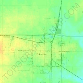
Name: Columbus topographic map, elevation, terrain.

Location: Columbus, Cherokee County, Kansas, 66725, United States (37.15804 -94.86799 37.19285 -94.81714)

Average elevation: 902 ft

Minimum elevation: 853 ft

Maximum elevation: 938 ft

Cherokee County trails, hiking, mountain biking, running and outdoor activities

Other topographic maps

Click on a map to view its topography, its elevation and its terrain.
East Galena

United States > Kansas > Cherokee County > Galena

Average elevation: 945 ft

Sherwin

United States > Kansas > Cherokee County

Average elevation: 853 ft

Gear up for your next adventure:

⌚GPS Sports Watch - GPS watch for running, hiking and training
🏔️Mountain Trail Maps - High‑detail maps for popular peaks
❄️Traction Cleats - Prevent slips on icy trails during winter hikes
🔭Compact Binoculars - HD vision for scouting terrain and identifying distant landmarks
🚪Portable Camp Chair - Foldable chair for comfort at camp

As an Amazon Associate, this site earns from qualifying purchases at no extra cost to you.