
Columbus topographic map
Click on the map to display elevation.
About this map
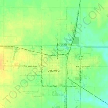
Name: Columbus topographic map, elevation, terrain.
Location: Columbus, Cherokee County, Kansas, 66725, United States (37.15804 -94.86799 37.19285 -94.81714)
Average elevation: 902 ft
Minimum elevation: 853 ft
Maximum elevation: 938 ft
Cherokee County trails, hiking, mountain biking, running and outdoor activities
Other topographic maps
Click on a map to view its topography, its elevation and its terrain.