Geolocate

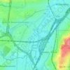
Anderlecht topographic map

Click on the map to display elevation.

About this map

Name: Anderlecht topographic map, elevation, terrain.

Location: Anderlecht, Brussels-Capital, 1070, Belgium (50.80706 4.24377 50.85032 4.34011)

Average elevation: 141 ft

Minimum elevation: 52 ft

Maximum elevation: 351 ft

Other topographic maps

Click on a map to view its topography, its elevation and its terrain.
Aa

Belgium > Brussels-Capital > Anderlecht

Average elevation: 115 ft

Aa

Belgium > Brussels-Capital > Anderlecht

Average elevation: 115 ft

Gear up for your next adventure:

🧭GPS Watch Accessories - Bands and chargers for GPS watches
🎒Trekking Poles - Sturdy poles for balance and stability on rough terrain
🎒Hydration Pack - Hands‑free water reservoir for long hikes
🏥Hiking First Aid Kits - Comprehensive medical kits for remote trail injuries
🛡️Insect Repellent - Protection against bugs during outdoor activities

As an Amazon Associate, this site earns from qualifying purchases at no extra cost to you.