
Allied Gardens topographic map
Interactive map
Click on the map to display elevation.
About this map
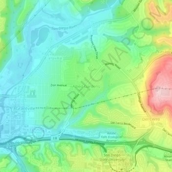
Name: Allied Gardens topographic map, elevation, terrain.
Average elevation: 292 ft
Minimum elevation: 56 ft
Maximum elevation: 827 ft
San Diego County trails, hiking, mountain biking, running and outdoor activities
Other topographic maps
Click on a map to view its topography, its elevation and its terrain.
Torrey Pines State Natural Reserve
United States > California > San Diego County > San Diego
Average elevation: 121 ft
Los Peñasquitos Canyon Preserve
United States > California > San Diego County > San Diego > Sorrento Valley
Average elevation: 312 ft