Geolocate

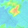
Pommenauque topographic map

Click on the map to display elevation.

About this map

Name: Pommenauque topographic map, elevation, terrain.

Location: Pommenauque, Carentan, Carentan-les-Marais, Saint-Lô, Manche, Normandie, France métropolitaine, 50500, France (49.28967 -1.28552 49.32967 -1.24552)

Average elevation: 26 ft

Minimum elevation: -10 ft

Maximum elevation: 108 ft

Other topographic maps

Click on a map to view its topography, its elevation and its terrain.
Carentan

France > Normandie > Manche > Carentan-les-Marais

Average elevation: 30 ft

Les Veys

France > Normandie > Manche > Carentan-les-Marais

Average elevation: 30 ft

Houesville

France > Normandie > Manche > Carentan-les-Marais

Average elevation: 39 ft

Vierville

France > Normandie > Manche > Carentan-les-Marais

Average elevation: 33 ft

Carentan

France > Normandie > Manche > Carentan-les-Marais

Average elevation: 30 ft

Carentan

France > Normandie > Manche > Carentan-les-Marais

Average elevation: 30 ft

Gear up for your next adventure:

👟Men's Trail Runners - Lightweight footwear for fast-paced exploration and light hiking
🔪Outdoor Multitools - Essential survival tools for gear repair and field use
🎒Hydration Pack - Hands‑free water reservoir for long hikes
📦Gear Storage Bags - Organize and protect outdoor equipment
🔋Rechargeable Batteries - Power up your outdoor devices

As an Amazon Associate, this site earns from qualifying purchases at no extra cost to you.