Geolocate

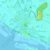
Kampung Sembilan topographic map

Click on the map to display elevation.

About this map

Name: Kampung Sembilan topographic map, elevation, terrain.

Location: Kampung Sembilan, Malacca City, Central Malacca, Malacca, 75200, Malaysia (2.18554 102.20926 2.22554 102.24926)

Average elevation: 13 ft

Minimum elevation: 0 ft

Maximum elevation: 52 ft

Other topographic maps

Click on a map to view its topography, its elevation and its terrain.
Morten Village

Malaysia > Malacca > Malacca City

Average elevation: 23 ft

Sungai Malim

Malaysia > Malacca > Malacca City

Average elevation: 20 ft

Sungai Malim

Malaysia > Malacca > Malacca City

Average elevation: 20 ft

Morten Village

Malaysia > Malacca > Malacca City

Average elevation: 23 ft

Upeh Island

Malaysia > Malacca > Malacca City

The state of Malacca covers an area of 1,775 km2 (685 sq mi). It located on the southwestern coast of the Malay Peninsula opposite Sumatra, with the state of Negeri Sembilan to the north and west and Johor to the east. Malacca is situated roughly two-thirds of the way down the west coast, 149 km (93 mi) south…

Average elevation: 0 ft
Gear up for your next adventure:

🧣Merino Neck Gaiters - Multi-functional headwear for wind and sun protection
🌡️Handheld Weather Meters - Measure wind, temp, and pressure for safe mountain travel
🪶Camping Sleeping Pad - Comfortable sleeping pad for backpacking
🔦Compact Flashlight - Reliable flashlight for emergencies
🔋Rechargeable Batteries - Power up your outdoor devices

As an Amazon Associate, this site earns from qualifying purchases at no extra cost to you.