
Thank you for supporting this site ❤️
Make a donation
Make a donation
Gear up for your next adventure:
As an Amazon Associate, this site earns from qualifying purchases at no extra cost to you.
Daihe topographic map
Click on the map to display elevation.
Thank you for supporting this site ❤️
Make a donation
Make a donation
Gear up for your next adventure:
As an Amazon Associate, this site earns from qualifying purchases at no extra cost to you.
About this map
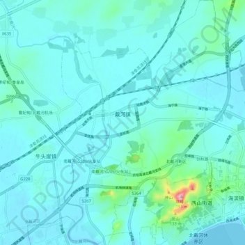
Name: Daihe topographic map, elevation, terrain.
Location: Daihe, Beidaihe District, Qinhuangdao City, Hebei, China (39.80707 119.40173 39.88623 119.49884)
Average elevation: 52 ft
Minimum elevation: -7 ft
Maximum elevation: 482 ft
Thank you for supporting this site ❤️
Make a donation
Make a donation
Gear up for your next adventure:
As an Amazon Associate, this site earns from qualifying purchases at no extra cost to you.