Geolocate

Penley topographic map

Click on the map to display elevation.

About this map

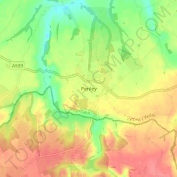
Name: Penley topographic map, elevation, terrain.

Location: Penley, Wrexham, Wales, LL13 0LQ, United Kingdom (52.93188 -2.89287 52.97188 -2.85287)

Average elevation: 217 ft

Minimum elevation: 95 ft

Maximum elevation: 322 ft

Other topographic maps

Click on a map to view its topography, its elevation and its terrain.

Gwersyllt

United Kingdom > Wales > Wrexham

Average elevation: 367 ft

Penycae

United Kingdom > Wales > Wrexham

Average elevation: 1,148 ft

Rhosddu

United Kingdom > Wales > Wrexham

Average elevation: 289 ft

Bangor-on-Dee

United Kingdom > Wales > Wrexham

Average elevation: 98 ft

Cefn

United Kingdom > Wales > Wrexham > Acrefair

Average elevation: 466 ft

Gear up for your next adventure:

🪑Ultralight Camp Chairs - Portable seating for resting after a long day of mapping
🧺Microfiber Travel Towels - Compact and fast-drying towels for trail use
🌄Hiking Binoculars - Compact binoculars for scenic views and trail spotting
📖Nature Tracking Books - Learn to track wildlife and terrain
😴Insulated Sleeping Pads - Compact and warm pads for high-elevation camping

As an Amazon Associate, this site earns from qualifying purchases at no extra cost to you.