
Thank you for supporting this site ❤️
Make a donation
Make a donation
Gear up for your next adventure:
As an Amazon Associate, this site earns from qualifying purchases at no extra cost to you.
Liariis topographic map
Click on the map to display elevation.
Thank you for supporting this site ❤️
Make a donation
Make a donation
Gear up for your next adventure:
As an Amazon Associate, this site earns from qualifying purchases at no extra cost to you.
About this map
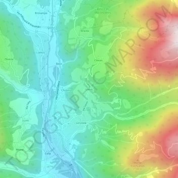
Name: Liariis topographic map, elevation, terrain.
Location: Liariis, Ovaro, Udine, Friuli-Venezia Giulia, 33025, Italy (46.47205 12.85602 46.51205 12.89602)
Average elevation: 2,635 ft
Minimum elevation: 1,526 ft
Maximum elevation: 5,030 ft
Thank you for supporting this site ❤️
Make a donation
Make a donation
Gear up for your next adventure:
As an Amazon Associate, this site earns from qualifying purchases at no extra cost to you.