Geolocate

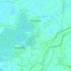
Telacsan topographic map

Click on the map to display elevation.

About this map

Name: Telacsan topographic map, elevation, terrain.

Location: Telacsan, Macabebe, Pampanga, Central Luzon, 2018, Philippines (14.93545 120.71844 14.94605 120.73109)

Average elevation: 10 ft

Minimum elevation: -3 ft

Maximum elevation: 16 ft

Other topographic maps

Click on a map to view its topography, its elevation and its terrain.

Batasan

Philippines > Pampanga > Macabebe

Average elevation: 10 ft

San Francisco

Philippines > Pampanga > Macabebe

Average elevation: 10 ft

Santa Rita

Philippines > Pampanga > Macabebe

Average elevation: 10 ft

San Roque

Philippines > Pampanga > Macabebe

Average elevation: 7 ft

Batasan

Philippines > Pampanga > Macabebe

Average elevation: 10 ft

Gear up for your next adventure:

🦟Ultrasonic Repellers - Create a bug-free zone at your camp or rest stop
💧Water Purification System - Clean water on the trail with reliable purifiers
🎒Trail Energy Bars - High‑calorie bars for hiking energy
🩳Quick‑Dry Hiking Shorts - Comfortable and quick‑dry shorts for summer hiking
⌚GPS Sports Watch - GPS watch for running, hiking and training

As an Amazon Associate, this site earns from qualifying purchases at no extra cost to you.