Geolocate

Rotherwick topographic map

Click on the map to display elevation.

About this map
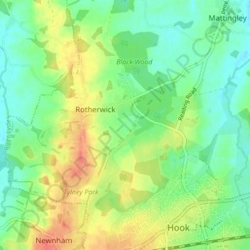
Name: Rotherwick topographic map, elevation, terrain.

Location: Rotherwick, Hart, Hampshire, England, United Kingdom (51.28369 -1.00230 51.31411 -0.94070)

Average elevation: 243 ft

Minimum elevation: 177 ft

Maximum elevation: 338 ft

Gear up for your next adventure:

🧢Outdoor Hiking Hat - Sun protection hat for outdoor explorers
🧢Sun Protection Hats - Wide-brimmed and UPF-rated hats for high-altitude sun safety
🥩Freeze-Dried Meals - Nutritious and lightweight food for remote expeditions
🔌Solar Panel Charger - Charge gear sustainably outdoors
🗻Climbing Gear Basics - Essential gear for beginner climbers

As an Amazon Associate, this site earns from qualifying purchases at no extra cost to you.