Geolocate

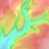
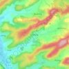
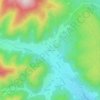
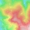
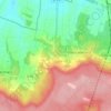
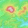
Grand Est topographic map

Click on the map to display elevation.

About this map

Name: Grand Est topographic map, elevation, terrain.

Location: Grand Est, Metropolitan France, 68127, France (47.92292 7.33178 48.04302 7.46364)

Average elevation: 656 ft

Minimum elevation: 610 ft

Maximum elevation: 830 ft

Other topographic maps

Click on a map to view its topography, its elevation and its terrain.
Strasbourg

France > Grand Est > Bas-Rhin > Strasbourg

Average elevation: 505 ft

Château Orquevaux

France > Grand Est > Haute-Marne > Orquevaux

Average elevation: 1,188 ft

Ath

France > Grand Est > Bas-Rhin > Diemeringen

Average elevation: 837 ft

Langres

France > Grand Est > Haute-Marne > Langres > Langres

Average elevation: 1,296 ft

Les Sources

France > Grand Est > Vosges > Bussang

Average elevation: 2,644 ft

Helling

France > Grand Est > Moselle

Average elevation: 797 ft

Le Village

France > Grand Est > Aube > Dolancourt

Average elevation: 666 ft

Bassin des Marquisades

France > Grand Est > Ardennes > Les Mazures

Average elevation: 1,112 ft

Les Ajots

France > Grand Est > Haute-Marne > Saint-Dizier

Average elevation: 505 ft

Schweighouse

France > Grand Est > Haut-Rhin > Lautenbach

Average elevation: 1,634 ft

Fort St Michel

France > Grand Est > Meuse > Belleville-sur-Meuse

Average elevation: 896 ft

Taubensee

France > Grand Est > Bas-Rhin > Niederbronn-les-Bains

Average elevation: 1,299 ft

Lemont

France > Grand Est > Meurthe-et-Moselle > Cosnes-et-Romain

Average elevation: 1,191 ft

Alamont

France > Grand Est > Meuse > Spincourt

Average elevation: 768 ft

Le Haut des Monts

France > Grand Est > Bas-Rhin > Belmont

Average elevation: 2,785 ft

La Puce

France > Grand Est > Meurthe-et-Moselle > Boismont

Average elevation: 938 ft

Mansard

France > Grand Est > Meuse > Dombasle-en-Argonne

Average elevation: 935 ft

Bois Colbert

France > Grand Est > Ardennes > Bergnicourt

Average elevation: 305 ft

Les Côtes Jopin

France > Grand Est > Marne > Changy

Average elevation: 433 ft

Montchenot

France > Grand Est > Marne

Average elevation: 614 ft

Nonsard

France > Grand Est > Meuse > Nonsard-Lamarche

Average elevation: 741 ft

Croix Allart

France > Grand Est > Marne > Bétheny

Average elevation: 308 ft

Praire

France > Grand Est > Meuse > Sorcy-Saint-Martin

Average elevation: 827 ft

Le Climont

France > Grand Est > Bas-Rhin > Urbeis

Average elevation: 2,037 ft

Altenstadt

France > Grand Est > Bas-Rhin > Wissembourg

Average elevation: 564 ft

Schaeferhof

France > Grand Est > Haut-Rhin > Kembs

Average elevation: 810 ft

Montormentier

France > Grand Est > Haute-Marne > Cusey

Average elevation: 886 ft

Gear up for your next adventure:

📻Weather Alert Radios - Stay informed of storm risks while off-the-grid
🚪Portable Camp Chair - Foldable chair for comfort at camp
🏔️Mountain Trail Maps - High‑detail maps for popular peaks
🛡️Bear Spray Outdoor - Protection in bear country hikes
🛠️Backpacking Tool Kit - Essential toolkit for outdoor repairs

As an Amazon Associate, this site earns from qualifying purchases at no extra cost to you.