Geolocate
👉 Easily get elevation data in JSON, GeoTIFF and KML formats using Elevation API
Thank you for supporting this site ❤️
Make a donation

Naujan topographic map

Click on the map to display elevation.

About this map

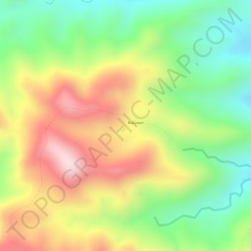
Name: Naujan topographic map, elevation, terrain.

Location: Naujan, Calapan, Oriental Mindoro, Mimaropa, Philippines (13.20662 121.41662 13.20672 121.41672)

Average elevation: 827 ft

Minimum elevation: 194 ft

Maximum elevation: 1,512 ft

Other topographic maps

Click on a map to view its topography, its elevation and its terrain.

Masipit

Philippines > Oriental Mindoro > Calapan

Average elevation: 13 ft

Lalud

Philippines > Oriental Mindoro > Calapan

Average elevation: 26 ft

Tibag

Philippines > Oriental Mindoro > Calapan

Average elevation: 16 ft

Santo Niño

Philippines > Oriental Mindoro > Calapan

Average elevation: 62 ft

Camilmil

Philippines > Oriental Mindoro > Calapan

Average elevation: 39 ft

Gear up for your next adventure:

❄️Traction Cleats - Prevent slips on icy trails during winter hikes
🪶Fire Starter Kit - Reliable fire starter for survival and camping
🥾Men's Hiking Boots - Durable, waterproof footwear for rugged terrain and steep inclines
🌡️Portable Weather Meter - Track weather conditions on the trail
🧥Men's Rain Shells - Premium waterproof and breathable jackets for mountain weather

As an Amazon Associate, this site earns from qualifying purchases at no extra cost to you.