Geolocate

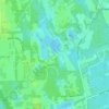
Sugar Mill Estates topographic map

Click on the map to display elevation.

About this map

Name: Sugar Mill Estates topographic map, elevation, terrain.

Location: Sugar Mill Estates, New Smyrna Beach, Volusia County, Florida, 32168, United States (29.02387 -81.00256 29.06387 -80.96256)

Average elevation: 23 ft

Minimum elevation: -7 ft

Maximum elevation: 46 ft

Other topographic maps

Click on a map to view its topography, its elevation and its terrain.
Gear up for your next adventure:

🗺️Topographic Maps - Detailed topo maps for hiking, exploring and outdoor navigation
🏕️Tent Footprint - Protect your tent base from wear
🧭Outdoor Navigation Book - Learn advanced navigation skills
🧤Tactile Hiking Gloves - Keep hands warm while operating GPS and smartphone screens
🪑Ultralight Camp Chairs - Portable seating for resting after a long day of mapping

As an Amazon Associate, this site earns from qualifying purchases at no extra cost to you.