Geolocate

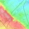
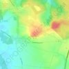
Estrée-Blanche topographic map

Click on the map to display elevation.

About this map

Name: Estrée-Blanche topographic map, elevation, terrain.

Location: Estrée-Blanche, Béthune, Pas-de-Calais, Hauts-de-France, Metropolitan France, 62145, France (50.57775 2.30080 50.60902 2.34408)

Average elevation: 236 ft

Minimum elevation: 118 ft

Maximum elevation: 335 ft

Other topographic maps

Click on a map to view its topography, its elevation and its terrain.

Panehem

France > Hauts-de-France > Pas-de-Calais > Samer

Average elevation: 230 ft

Cap Blanc Nez

France > Hauts-de-France > Pas-de-Calais > Escalles

Average elevation: 108 ft

Noyelles

France > Hauts-de-France > Pas-de-Calais > Bours

Average elevation: 410 ft

Le Petit Vimy

France > Hauts-de-France > Pas-de-Calais > Vimy

Average elevation: 305 ft

Entre Deux Chemins

France > Hauts-de-France > Pas-de-Calais > Herly

Average elevation: 558 ft

Mont Pourri

France > Hauts-de-France > Pas-de-Calais > Saint-Aubin

Average elevation: 105 ft

Gear up for your next adventure:

🎒Outdoor Daypacks - Lightweight backpacks designed for carrying maps and essential gear
🪶Wildlife Field Guides - Learn animal tracking and species ID
🔌Solar Panel Charger - Charge gear sustainably outdoors
🪶Compact Camp Shovel - Folding shovel for campsite tasks
🧥Waterproof Jacket for Hiking - Breathable and rugged rain jacket for outdoor excursions

As an Amazon Associate, this site earns from qualifying purchases at no extra cost to you.