Geolocate

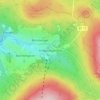
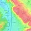
Bischofsgrüner Forst topographic map

Click on the map to display elevation.

About this map

Name: Bischofsgrüner Forst topographic map, elevation, terrain.

Location: Bischofsgrüner Forst, Landkreis Bayreuth, Bavaria, Germany (50.02498 11.72299 50.09546 11.84891)

Average elevation: 2,470 ft

Minimum elevation: 1,864 ft

Maximum elevation: 3,432 ft

Other topographic maps

Click on a map to view its topography, its elevation and its terrain.
Plösen

Germany > Bavaria > Landkreis Bayreuth

Average elevation: 1,473 ft

Fröbershammer

Germany > Bavaria > Landkreis Bayreuth > Birnstengel

Average elevation: 2,484 ft

Spies

Germany > Bavaria > Landkreis Bayreuth > Betzenstein

Average elevation: 1,752 ft

Pfarrhügel

Germany > Bavaria > Landkreis Bayreuth > Eckersdorf

Average elevation: 1,663 ft

Meinberg

Germany > Bavaria > Landkreis Bayreuth > Goldkronach

Average elevation: 1,476 ft

Gottelhof

Germany > Bavaria > Landkreis Bayreuth > Hollfeld

Average elevation: 1,335 ft

Reizendorf

Germany > Bavaria > Landkreis Bayreuth > Ahorntal

Average elevation: 1,427 ft

Röhrig

Germany > Bavaria > Landkreis Bayreuth > Bindlacher Berg

Average elevation: 1,345 ft

Gear up for your next adventure:

🕶️Glacier Sunglasses - Side shields to protect eyes from high-altitude snow glare
🥾Hiking Shoes - Durable and comfortable shoes for trail hiking
🧭Map Reading Tools - Tools and kits for map navigation
🎒Outdoor Daypacks - Lightweight backpacks designed for carrying maps and essential gear
🩳Quick‑Dry Hiking Shorts - Comfortable and quick‑dry shorts for summer hiking

As an Amazon Associate, this site earns from qualifying purchases at no extra cost to you.