Geolocate

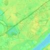
Meiderich/Beeck topographic map

Click on the map to display elevation.

About this map

Name: Meiderich/Beeck topographic map, elevation, terrain.

Location: Meiderich/Beeck, Duisburg, North Rhine-Westphalia, Germany (51.44725 6.68093 51.49601 6.82216)

Average elevation: 102 ft

Minimum elevation: 43 ft

Maximum elevation: 272 ft

Other topographic maps

Click on a map to view its topography, its elevation and its terrain.
Viktoria Park

Germany > North Rhine-Westphalia > Duisburg

Average elevation: 102 ft

Gear up for your next adventure:

🎒Trail Energy Bars - High‑calorie bars for hiking energy
🗺️Topographic Maps - Detailed topo maps for hiking, exploring and outdoor navigation
📖Nature Tracking Books - Learn to track wildlife and terrain
🌲Outdoor Survival Books - Best books on survival skills
🧺Microfiber Travel Towels - Compact and fast-drying towels for trail use

As an Amazon Associate, this site earns from qualifying purchases at no extra cost to you.