Geolocate

Mileto topographic map

Click on the map to display elevation.

About this map

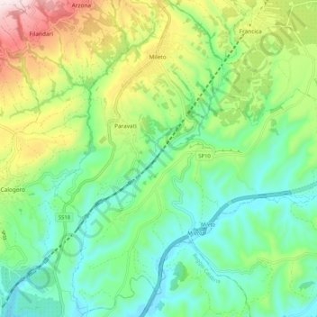
Name: Mileto topographic map, elevation, terrain.

Location: Mileto, Vibo Valentia, Calabria, 89052, Italy (38.54393 16.03577 38.62282 16.13852)

Average elevation: 784 ft

Minimum elevation: 194 ft

Maximum elevation: 2,034 ft

Gear up for your next adventure:

🏔️Mountain Trail Maps - High‑detail maps for popular peaks
🔥Plasma Lighters - Windproof lighters that work in any weather condition
🏕️Tent Footprint - Protect your tent base from wear
🌎3D Topographic Globes - Raised relief globes for a tactile understanding of geography
🧥Men's Rain Shells - Premium waterproof and breathable jackets for mountain weather

As an Amazon Associate, this site earns from qualifying purchases at no extra cost to you.