Geolocate

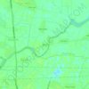
Dai Dong Commune topographic map

Click on the map to display elevation.

About this map

Name: Dai Dong Commune topographic map, elevation, terrain.

Location: Dai Dong Commune, Bắc Ninh City, Vietnam (21.06871 105.97634 21.13064 106.02292)

Average elevation: 30 ft

Minimum elevation: 3 ft

Maximum elevation: 384 ft

Other topographic maps

Click on a map to view its topography, its elevation and its terrain.

Kinh Bac

Vietnam > Bắc Ninh City

Average elevation: 26 ft

Que Vo

Vietnam > Bắc Ninh City

Average elevation: 26 ft

Thuan Thanh

Vietnam > Bắc Ninh City

Average elevation: 20 ft

Yen Tu

Vietnam > Bắc Ninh City > Yen Phong Ward > Chờ

Average elevation: 20 ft

Gear up for your next adventure:

🦶Hiking Gaiters - Keep debris and water out of your boots
⌚GPS Sports Watch - GPS watch for running, hiking and training
🪶Fire Starter Kit - Reliable fire starter for survival and camping
🧴Hand Sanitizer - Keep hands clean while hiking
🌄Hiking Binoculars - Compact binoculars for scenic views and trail spotting

As an Amazon Associate, this site earns from qualifying purchases at no extra cost to you.