
Sendamal topographic map
Click on the map to display elevation.
About this map
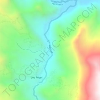
Name: Sendamal topographic map, elevation, terrain.
Location: Sendamal, Huasmin, Celendín, Cajamarca, Perú (-6.83224 -78.26350 -6.79922 -78.24908)
Average elevation: 6,467 ft
Minimum elevation: 5,220 ft
Maximum elevation: 8,960 ft
Other topographic maps
Click on a map to view its topography, its elevation and its terrain.