Geolocate

Simonswald topographic map

Click on the map to display elevation.

About this map

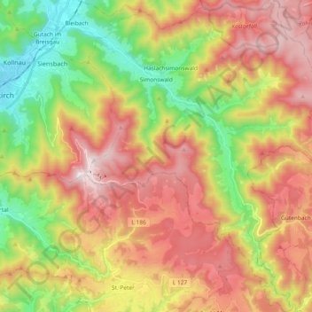
Name: Simonswald topographic map, elevation, terrain.

Location: Simonswald, VVG der Stadt Waldkirch, Landkreis Emmendingen, Baden-Württemberg, 79263, Germany (48.00813 8.01271 48.13149 8.16643)

Average elevation: 2,428 ft

Minimum elevation: 876 ft

Maximum elevation: 4,058 ft

Other topographic maps

Click on a map to view its topography, its elevation and its terrain.

Gear up for your next adventure:

❄️Traction Cleats - Prevent slips on icy trails during winter hikes
🪶Camp Gear Gift Set - Perfect gift bundle for outdoor fans
🥤Water Filter Bottle - All‑in‑one filter bottle for safe hydration
🧭Map Reading Tools - Tools and kits for map navigation
💧Water Filtration Bottles - Safely drink from streams and lakes while exploring

As an Amazon Associate, this site earns from qualifying purchases at no extra cost to you.