Geolocate

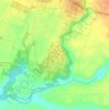
Tawangargo topographic map

Click on the map to display elevation.

About this map

Name: Tawangargo topographic map, elevation, terrain.

Location: Tawangargo, Kabupaten Malang, East Java, 65324, Indonesia (-7.88993 112.55103 -7.84993 112.59103)

Average elevation: 2,533 ft

Minimum elevation: 2,083 ft

Maximum elevation: 3,054 ft

Other topographic maps

Click on a map to view its topography, its elevation and its terrain.
Pulau Sempu

Indonesia > East Java > Kabupaten Malang

Average elevation: 85 ft

Sungai Brantas

Indonesia > East Java > Kabupaten Malang > Sukoraharjo

Average elevation: 1,391 ft

Tegalsari

Indonesia > East Java > Kabupaten Malang

Average elevation: 1,040 ft

Pulau Sempu

Indonesia > East Java > Kabupaten Malang

Average elevation: 85 ft

Gear up for your next adventure:

🥘Titanium Cookware - Durable, featherlight pots and pans for backpacking
🕶️Glacier Sunglasses - Side shields to protect eyes from high-altitude snow glare
🎒Trekking Poles - Sturdy poles for balance and stability on rough terrain
🧭GPS Watch Accessories - Bands and chargers for GPS watches
📷Action Cameras - Rugged cameras to document your journeys across rugged terrain

As an Amazon Associate, this site earns from qualifying purchases at no extra cost to you.