Geolocate

82152 topographic map

Click on the map to display elevation.

About this map

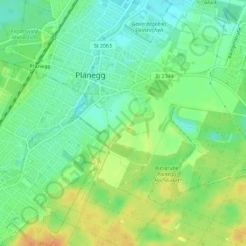
Name: 82152 topographic map, elevation, terrain.

Location: 82152, Planegg, Landkreis München, Bayern, Deutschland (48.09840 11.42738 48.09850 11.42748)

Average elevation: 1,821 ft

Minimum elevation: 1,772 ft

Maximum elevation: 1,886 ft

Other topographic maps

Click on a map to view its topography, its elevation and its terrain.

Martinsried

Deutschland > Bayern > Landkreis München > Planegg

Average elevation: 1,801 ft

Steinkirchen

Deutschland > Bayern > Landkreis München > Planegg > Martinsried

Average elevation: 1,801 ft

Gear up for your next adventure:

🌐World Map Poster - Decorative world maps with topographic info
🌧️Backpack Rain Cover - Keep gear dry in wet weather
🥾Women's Hiking Boots - Top-rated trail boots with ankle support and superior grip
🧭Map Reading Tools - Tools and kits for map navigation
🎁Geography Themed Gifts - Unique gift ideas for map lovers and geography enthusiasts

As an Amazon Associate, this site earns from qualifying purchases at no extra cost to you.