Geolocate

Lido topographic map

Click on the map to display elevation.

About this map

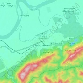
Name: Lido topographic map, elevation, terrain.

Location: Lido, Margherita, Tinsukia, Assam, 786182, India (27.25452 95.69688 27.33452 95.77688)

Average elevation: 620 ft

Minimum elevation: 312 ft

Maximum elevation: 1,542 ft

Other topographic maps

Click on a map to view its topography, its elevation and its terrain.

Burhi Dehing River

India > Assam > Margherita

Average elevation: 531 ft

Gear up for your next adventure:

📱Heavy-Duty Phone Cases - Drop-proof and waterproof protection for outdoor navigation
🪶LED Camping Lantern - Bright lantern for camp lighting
🔋Rechargeable Batteries - Power up your outdoor devices
🦶Carbon Trekking Poles - Reduce knee impact on steep descents with ultra-light poles
📦Dry Bags Set - Waterproof storage for electronics and clothes

As an Amazon Associate, this site earns from qualifying purchases at no extra cost to you.