
Make a donation
Gear up for your next adventure:
As an Amazon Associate, this site earns from qualifying purchases at no extra cost to you.
Rifle topographic map
Click on the map to display elevation.
Make a donation
Gear up for your next adventure:
As an Amazon Associate, this site earns from qualifying purchases at no extra cost to you.
About this map
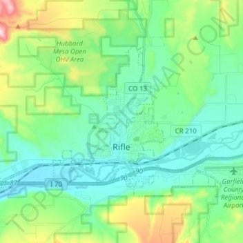
Name: Rifle topographic map, elevation, terrain.
Location: Rifle, Garfield County, Colorado, 81650, United States (39.51492 -107.84737 39.57478 -107.72263)
Average elevation: 5,679 ft
Minimum elevation: 5,243 ft
Maximum elevation: 7,051 ft
Garfield County trails, hiking, mountain biking, running and outdoor activities
Make a donation
Gear up for your next adventure:
As an Amazon Associate, this site earns from qualifying purchases at no extra cost to you.
Other topographic maps
Click on a map to view its topography, its elevation and its terrain.
Douglas Pass
United States > Colorado > Garfield County
Douglas Pass, elevation 8,205 feet (2,501 meters), is a mountain pass in the Book Cliffs of western Colorado. It is located in Garfield County and is traversed by State Highway 139. The pass divides the watersheds of West Douglas Creek to the north and East Salt Creek to the south. It is named for the Northern…
Average elevation: 7,989 ft
Make a donation
Gear up for your next adventure:
As an Amazon Associate, this site earns from qualifying purchases at no extra cost to you.