
Thank you for supporting this site ❤️
Make a donation
Make a donation
Gear up for your next adventure:
As an Amazon Associate, this site earns from qualifying purchases at no extra cost to you.
Thansing topographic map
Click on the map to display elevation.
Thank you for supporting this site ❤️
Make a donation
Make a donation
Gear up for your next adventure:
As an Amazon Associate, this site earns from qualifying purchases at no extra cost to you.
About this map
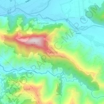
Name: Thansing topographic map, elevation, terrain.
Location: Thansing, Likhu, Nuwakot, Bagmati Province, Nepal (27.86331 85.20604 27.90331 85.24604)
Average elevation: 2,339 ft
Minimum elevation: 1,745 ft
Maximum elevation: 3,780 ft
Thank you for supporting this site ❤️
Make a donation
Make a donation
Gear up for your next adventure:
As an Amazon Associate, this site earns from qualifying purchases at no extra cost to you.