
Make a donation
Gear up for your next adventure:
As an Amazon Associate, this site earns from qualifying purchases at no extra cost to you.
La Paz topographic map
Click on the map to display elevation.
Make a donation
Gear up for your next adventure:
As an Amazon Associate, this site earns from qualifying purchases at no extra cost to you.
About this map
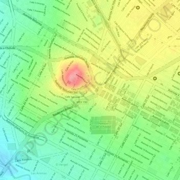
Name: La Paz topographic map, elevation, terrain.
Location: La Paz, Municipio de Puebla, Puebla, México (19.05301 -98.22494 19.05390 -98.22404)
Average elevation: 7,057 ft
Minimum elevation: 6,886 ft
Maximum elevation: 7,260 ft
Make a donation
Gear up for your next adventure:
As an Amazon Associate, this site earns from qualifying purchases at no extra cost to you.
Other topographic maps
Click on a map to view its topography, its elevation and its terrain.
Lomas del Valle
México > Puebla > Municipio de Puebla > San Francisco Totimehuacán
Average elevation: 6,932 ft
Estrellas del Sur
México > Puebla > Municipio de Puebla > Puebla de Zaragoza
Average elevation: 6,965 ft