
Cerro Avispa topographic map
Interactive map
Click on the map to display elevation.
About this map
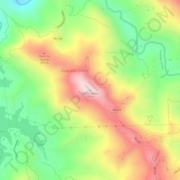
Name: Cerro Avispa topographic map, elevation, terrain.
Location: Cerro Avispa, Adjuntas, Puerto Rico, 00631, United States (18.20518 -66.81884 18.20528 -66.81874)
Average elevation: 1,775 ft
Minimum elevation: 1,138 ft
Maximum elevation: 2,411 ft
Puerto Rico trails, hiking, mountain biking, running and outdoor activities
Other topographic maps
Click on a map to view its topography, its elevation and its terrain.