
Make a donation
Gear up for your next adventure:
As an Amazon Associate, this site earns from qualifying purchases at no extra cost to you.
Dansby topographic map
Click on the map to display elevation.
Make a donation
Gear up for your next adventure:
As an Amazon Associate, this site earns from qualifying purchases at no extra cost to you.
About this map
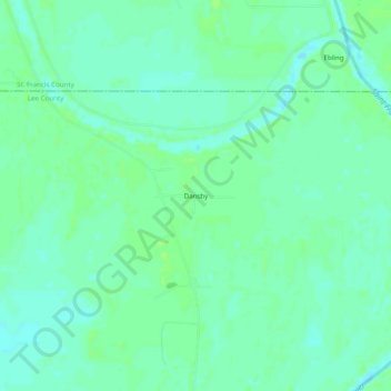
Name: Dansby topographic map, elevation, terrain.
Location: Dansby, Lee County, Arkansas, United States (34.87426 -90.66038 34.91426 -90.62038)
Average elevation: 194 ft
Minimum elevation: 177 ft
Maximum elevation: 207 ft
Lee County trails, hiking, mountain biking, running and outdoor activities
Make a donation
Gear up for your next adventure:
As an Amazon Associate, this site earns from qualifying purchases at no extra cost to you.
Other topographic maps
Click on a map to view its topography, its elevation and its terrain.
Marianna
United States > Arkansas > Lee County
The town lies along the west side of the L'Anguille River two miles west of that stream's confluence with the St. Francis River within a break in elevation of Crowley's Ridge.
Average elevation: 213 ft